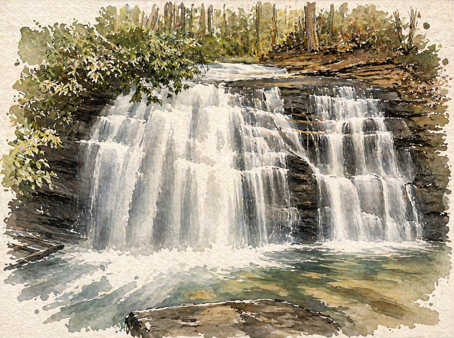
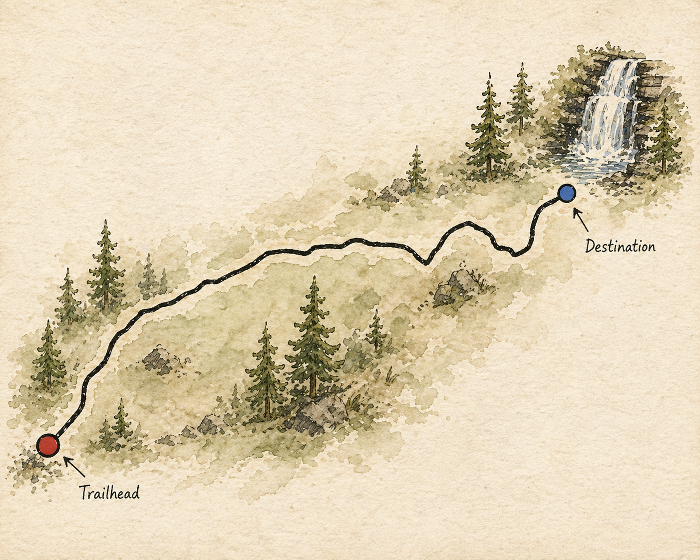
Tucked deep in the Chattahoochee National Forest, Long Creek Falls drops across a series of mossed shelves on the Benton MacKaye Trail. It's a rewarding approach with a big payoff, and a place that stays with you.
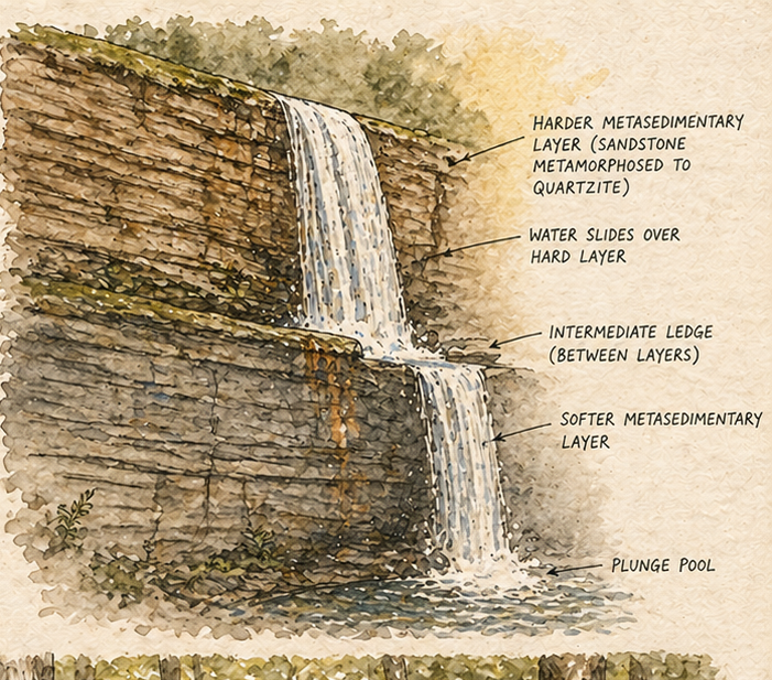
Formed over millennia, Long Creek Falls is the kind of place that reminds you how water, rock, and time shape everything. The approach follows an old logging cut and forest trail, crossing the creek and climbing steadily toward the sound of falling water.
At the top, the view opens. Spray in the air, forest in every direction, and the full force of the falls right in front of you.